Intuitive Scene Editing
Supports OSGB, terrain, models; procedurally generate city models with one click
Convert GIS formats
Convert OSGB/RVT/OBJ to 3DTiles, DWG/GeoTIFF to tiles
Powerful, Free GIS Server
Support TMS/WMTS/WMS/WFS and data from GeoJSON/SHP/PostGIS
Editor
Converter
Server
part1-2 part1-3
Why Choose GISBox?
card-video play
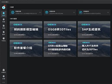
Lightweight & All-in-One GIS Platform
An integrated client-server application. Double-click to install and toggle BS mode with one click.
card-video play
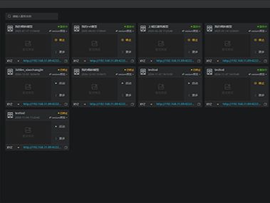
Built-in GIS Server, Completely Free
GIS server offers fully free access to all its features; it is powerful yet easy to use, and supports all types of OGC standards.
card-video play
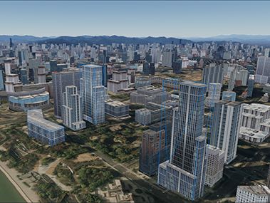
Powerful 3D Processing Capabilities
Real-time editing of 3D scenes like OSGB and terrain; generate 3D city models with one click.
Intuitive 3D Scene Editing
part3-1 part3-2 part3-3 part3-4 part3-5
OSGB Edit
Supports online editing of OSGB models including surface repair, riverbed suppression, and terrain alignment.
Procedural Model
Instant 3D city generation from any map area, powered by procedural modeling.
Terrain Edit
Edit terrain by selecting areas with shapes (polygons, cubes) and adjusting offset for alignment.
Water Rendering
Import DEM data to create a water surface for Cesium and export it as a WaterMask format.
BIM Import
Lightweight import of mainstream BIM formats, reducing data redundancy via LOD and instancing storage.
Various GIS Formats Conversion
Tiling, Conversion, and Retiling
OSGB
3DTiles
GeoTIFF
Terrain Tile
Image
Image Tile
FBX/OBJ...
3DTiles
LAS
3DTiles
GS
3DTiles
RVT
3DTiles
IFC
3DTiles
DWG
Imagery Tile
3DTiles
OSGB
S3M
OSGB
I3S
OSGB
Hash File
GBP
GBP
Hash File
Gaussian
3DTiles
Free & Lightweight GIS Service
Full OGC Compliance: WMS, WMTS, WFS & WCS Support
Data Sources
Files/Folders
3DTiles
OSGB
GeoTIFF
Terrain Layer
Imagery Layer
DWG
GeoJSON
GeoPackage
SHP
Databases
PostGIS
Oracle Spatial
External Services
WMS
WMTS
Service Protocols
2D
WMS
WMTS
TMS
WFS
WCS
WPS
3D
3DTiles
Terrain
Service Preview Framework
Cesium
OpenLayers
Leaflet
Mapbox

Product Matrix

The company's independently developed digital product ecosystem includes:

Banban Low-Code
Privately Deployed Low-Code Platform
CetusView
No-Code Digital Twin Visualization Platform
Washi IoT
1000+ IoT Device Data Collection Platform
Security & Compliance
A Sovereign, Secure and Certified GIS Platform
National High-tech Enterprise
AAA Credit Rating
AAA Credit Rating
Certified Software Enterprise
ISO9001 Certification
UnionTech UOS Certification
Huawei Cloud Certification